Šiprage
He die Sie ös op Stolberjer Platt
(Sije op Stolberjer Platt)
un jeschrieve wie moch öt kallt
(Sije jeschrieve wie moch öt kallt)
(Sije op Stolberjer Platt)
un jeschrieve wie moch öt kallt
(Sije jeschrieve wie moch öt kallt)
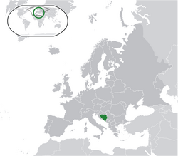
Šiprage es ön Siedlung ä Bosnie-Herzejowina, önö Staat ä Südeuropa.[1][2]
- Breetejraad: 44°27'56″
- Längejraad: 17°33'36″
- Hüüde: 507–520 m


Clima
ÄndereReferenzen
Ändere- ↑ http://www.kartabih.com/
- ↑ Vojnogeografski institut, Ed. (1962): Šiprage (List karte 1:25.000, Izohipse na 10 m). Vojnogeografski institut, Beograd / Military Geographical Institute, Ed. (1962): Šiprage (map sheet 1: 25.000, Contour lines at 10 m). Military Geographical Institute, Belgrade.
- ↑ https://en.climate-data.org/location/905786/
Weblink
Ändere- http://opstinakotorvaros.com/
- http://www.maplandia.com/bosnia-and-herzegovina/republika-srpska/siprage/ Maplandia
- http://www.satellitecitymaps.com/europe-map/bosnia-and-herzegovina-map/federation-of-bosnia-and-herzegovina-map/%C5%A1iprage-map/
- http://www.distancesfrom.com/distance-from-Siprage-to-Banja-Luka-Bosna-i-Hercegovina/DistanceHistory/5243320.aspx
- http://www.udaljenosti.com/bosna/- Distances in B&H